Tuesday, August 28, 2007
How to: Export a map to a .jpg (image)
For every exercise we do this semester, you will export your map to an image and then upload it to your blog so I can track your work. The following is a short demonstration on how to do this.
Monday, August 27, 2007
Module 2 - Data Models / ArcCatalog / Geodatabases
 INTRODUCTION
 When using a GIS, we work with abstractions of reality. The spatial data models are simplified representations of the world that suppport map display, querying, editing and analysis in a GIS. Data models are at the foundation of everything with do with a GIS.
LEARNING OBJECTIVES
- Describe how GIS represent the reality.
- Explain why coordinates are important in data models.
- Describe the two distinct types of data used to define cartographic objects.
- List several examples of things that could be represented in thematic layers.
- Describe the difference between cartesian coordinate systems and sperical coordinate systems.
- Describe the different attribute categories
- Describe the vector data model
- Describe the raster data model
- Describe the spaghetti data model
- Describe the advantages of using a topological data model
- Describe the relationship between vector features and attributes
- List some advantages and disadvantages of the vector and raster data models
- Describe Triangulated Irregular Networks
- Define object data model
- List common formats for spatial data
- Describe what ArcCatalog is used for
- Utilize ArcCatalog of managing spatial data
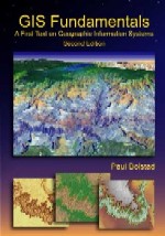
Lecture - GIS Fundamentals
- entities or phenomena
- spatial feature
- cartographic object
- data model
- coordinates
- thematic layers
- cartesian coordinate system
- orthogonal
- spherical coordinate system
- attributes
- nominal
- ordinal
- interval / ratio
- vector
- spaghetti data model
- topological data model
- topology
- planar topology
- raster
- cells
- cell dimension
- continuous
- discrete
- triangulated irregular network (TIN)
- digital elevation model (DEM)
- object data model
- data format
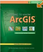
Lab - Getting to Know ArcGIS
- ArcCatalog
- catalog tree
- connect to folder
- file extension
- geodatabase
- feature class
- layer file
- shapefile
Lab: Getting to Know ArcGIS
- Chapter 4 - Exploring ArcCatalog
- Chapter 14 - Building Geodatabases
For next week lecture and class - GIS Fundamentals - Chapter 3 - Geodesy, Projections, and Coordinate Systems
HOMEWORK
Not
STUDY QUESTIONS
GIS Fundamentals, pp. 64-65 (do not do the coordinate conversion table)
GIS Fundamentals, pp. 64-65 (do not do the coordinate conversion table)
Friday, August 24, 2007
Module 1 - Getting started / Chapter 1 - GIS Fundamentals
 INTRODUCTION
Welcome to GIS 111 - Introduction to GIS. This semester we'll be looking a broad range of GIS characteristics, functions, and applications. This class will not go deep into any one topic but rather will touch on many subjects related to the heart of GIS. It's a great technology that can be a lot of fun to utilize so let's get started!
OUTLINE
- Class introductions
- Syllabus / Course expectations
- Discussion - Introduction to GIS - using textbooks
- GIS websites and examples
- Resources to learn GIS
- Introduce and demo ArcGIS
- Create Google Accounts / create blogs
- Active learning Exercise - i.e. lab
LEARNING OBJECTIVES
- Define GIS
- Define GISci
- Describe the major components of a GIS
- Describe the difference between Geographic Information Systems and Geographic Information Science
- Explain why we need GIS
- List several applications of GIS
- List several commercial GIS software products
- Describe ArcMap
- Describe ArcCatalog
- Open a map document
- Navigate the map in ArcMap using the tools toolbar
- View properties of a layer in ArcMap
- Utilize the measure tool in ArcMap
- Generate statistics from a layer in ArcMap
TERMS TO KNOW
-Lecture - GIS Fundamentals
- GIS
- spatial information
- ubiquitous
- data entry
- editing
- data management
- analysis
- output
-Lab - Getting to Know ArcGIS
- ArcGIS
- layers
- features
- shape
- size
- surfaces
- attributes
- spatial relationships
- table of contents
ACTIVE LEARNING EXERCISE - LAB WORK
- GTKArcGIS - Chapter 3 - Exploring ArcMap
** post to you blog - map from page 29 / step 20
** post to your blog - map from page page 38 / step 18
READING ASSIGNMENT
**normally, you will do the assigned reading before the class. For next week, you will need to read what we covered in class today and what we will cover next week.
- GIS Fundamentals - Chapter 1 - (PowerPoint available)
- GTKArcGIS - Chapter 1 and Chapter 2
- GIS Fundamentals - Chapter 2 -Data Models - next weeks topic
Create a blog for this class at http://www.blogger.com/. If you have a Gmail account, you can use it to log in to Blogger. If you don't have a Gmail account, you will have to create an account with Blogger. REMEMBER YOUR USERNAME. REMEMBER YOUR PASSWORD. REMEMBER YOUR BLOG ADDRESS! WRITE THEM ALL DOWN.
- Go to http://www.blogger.com
- Click on create a new blog
- CThe first step will be to reate an account (on blogger) using a valid email address
- Pick a title - this can be anything and does not have to be unique (someone else can have the same title). This can be changed later.
- Pick a URL (web address) for the blog. This will be http://SomeThingYouChoose.blogspot.com. Where SomethingYouChoose must be unique - i.e. no one else can have the same address.
- Pick a template - this can be changed at any time if you don't like the one you pick
- Make a post summarizing our first class.
- If you want to see some past student blogs ... see the side links on this blog.
GIS Fundamentals - page 23
Subscribe to:
Comments (Atom)


